
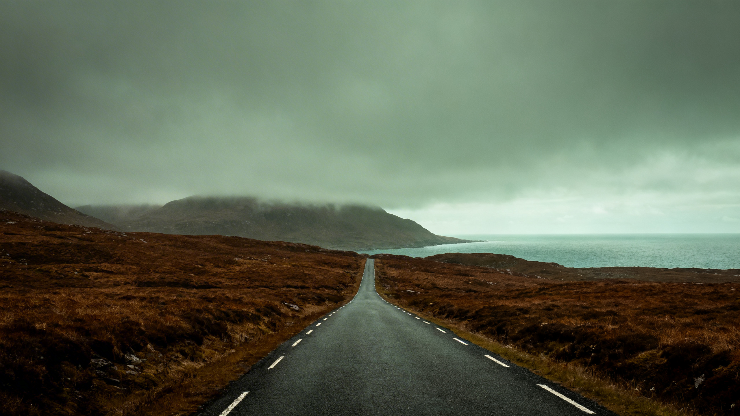
You're somewhere outside Clifden, on the N59, and the bog has just opened out to your left to give you the first proper Atlantic view of the morning. The sky is doing something theatrical. There's a sign for the Sky Road loop ahead. You haven't even started that yet, and you've already pulled over twice. This is what a Wild Atlantic Way self-drive actually feels like — not a conveyor belt of photogenic stops but a series of moments that stop you mid-sentence and hold you there.
The WAW runs for 2,500 kilometres along Ireland's western coastline. Nobody does all of it. Anyone who tells you otherwise is either exaggerating or has forgotten most of it. What you can do — and what's worth doing — is pick the section or two that fits your time and drive it properly, without rushing, without a schedule that turns every stop into a box to tick.
Here's how to approach it.
How Much of the Wild Atlantic Way Can You Realistically Drive?
The 2,500km figure is useful for understanding the scale of the thing. It's not useful for planning. In practice, the WAW breaks into three distinct geographic sections, each with its own character, and most visitors with two weeks will do two of the three well. With one week, you'll do one properly.
Kerry and West Cork (south section): The Ring of Kerry, the Dingle Peninsula, the Beara Peninsula, the Mizen Head. This is where most visitors start because it's closest to Cork and Kerry airports and the landscapes are immediately dramatic. It's also the busiest section in summer.
Clare, Galway, and Connemara (middle section): The Burren, the Cliffs of Moher, the coastal N59 from Galway out to Clifden, the Sky Road loop, Killary Harbour. Less saturated than Kerry, equally beautiful, and — particularly in Connemara — more likely to feel like you've found something rather than arrived somewhere everyone has already been.
Mayo, Sligo, and Donegal (north section): The section most visitors skip and most people who have done it say was their favourite. Slieve League. The Glencolmcille valley. Malin Head. Achill Island. The Donegal roads are quieter, the landscapes less immediately postcard-perfect and more raw and austere. Worth the detour north if your schedule allows.
If you have seven days and want to drive the WAW, our 7-day Ireland self-drive itinerary maps out one practical route — or choose one section and drive it without an agenda. If you try to connect all three in a week, you'll spend most of it behind the wheel and very little of it actually anywhere.
The Kerry Section

Kerry is where the WAW earns its reputation, and it earns it honestly. The Ring of Kerry anticlockwise — starting from Killarney, going west through Killorglin to Cahirciveen, then up through Waterville and Sneem and back — is a day that works. Go early, before the coach buses are moving, and go anticlockwise. The roads are narrow enough that meeting a 50-seat tour bus on the wrong section of the road is a defining experience of the trip, but not a pleasant one.
The Dingle Peninsula, which connects to the WAW just north of Tralee, is the argument for staying an extra day in Kerry. Tighter roads, fewer coaches, and a landscape that feels less organised for tourism. The Slea Head Drive — the circuit that takes you out around the tip of the Dingle Peninsula past Dunquin and the Blasket Island viewpoints — is the best single loop of road in Kerry. Go on a clear day if you can.
Both routes are covered in detail in their own guides. If you're planning the full Kerry section of the WAW, allow three days minimum — one for the Ring, one for Dingle, one to use however the mood takes you.
The Clare and Connemara Section

Drive south from Galway and you hit the Burren — a limestone plateau that looks like the surface of the moon and sits between Galway Bay and the Cliffs of Moher. The L-roads through the Burren are some of the most unusual driving in Ireland: flat, pale, wide-skied, with ancient ring forts and dolmens appearing out of stone walls at odd intervals.
The Cliffs of Moher are worth seeing, but see them early. By mid-morning in July they're crowded in a way that breaks the spell. At 7am on a clear morning in May, with the Atlantic below and the Aran Islands on the horizon, they're a different thing entirely.
North of Galway, the N59 out to Clifden is one of the great road drives in Ireland. Eighty kilometres of bog and lake and mountain, with the Twelve Bens on one side and the Atlantic opening up on the other. The Sky Road loop outside Clifden — a 12km circuit that climbs above the town and delivers views across Clifden Bay and back toward the Atlantic — is worth every minute.
Beyond Clifden, the road to Leenane runs along the southern shore of Killary Harbour, Ireland's only fjord. Parts of this stretch are single-track with passing places, and they're spectacular. GPS driving times in Connemara are wrong. Add 30–40% on any R-road and you'll be closer to reality.
The Donegal Section

This is where visitors who push north say the route repays the extra days most generously.
Slieve League — the sea cliffs on the southwest Donegal coast — stand over 600 metres at their highest point. They are nearly three times the height of the Cliffs of Moher and receive a fraction of the visitors. The road to the upper car park is narrow and steep, and the walk to the One Man's Pass ridge is not for those with a serious fear of heights. But the approach drive alone, down through the Donegal hills with the sea appearing and disappearing below you, is worth the detour.
Glencolmcille (Gleann Cholm Cille) is the valley at the far end of the road from Killybegs. There is almost nothing there in the conventional tourist sense. That is the point. The landscape is empty in the way that only the very far corners of Ireland get to be empty, and the road in and out gives you views of the Atlantic that don't have a car park or an ice cream van anywhere in sight.
Malin Head, the northernmost point on the island of Ireland, is a three-hour drive from Donegal town. Allow a full day for the Inishowen Peninsula loop, and go on a day when the weather is doing something dramatic. The Head is better in a storm than in sunshine.
What the Roads Are Actually Like
The N-roads — the national primary routes — are fine. Wide, well-surfaced, typically 80–100km/h. You will not find them difficult.
The R-roads are where it gets interesting. Many are single-track with passing places, which means pulling left into a passing bay and waiting for oncoming traffic to clear before continuing. It sounds more dramatic than it is. You will adapt to it within an hour. The anxiety that first-time drivers feel disappears quickly once you understand the rhythm of it.
GPS is not reliable in rural western Ireland. Roads that appear as driveable routes on Google Maps occasionally end at a farm gate or dissolve into a grass track. The solution is to use the GPS for orientation and general direction, but trust your eyes for the last kilometre. If the road looks wrong, it probably is.
Driving times in Connemara and Donegal specifically are consistently underestimated by navigation apps, which assume road conditions that don't apply on R-roads through bog and mountain. Add 30–40% to any GPS estimate in these areas and you'll be approximately right.
Planning Your Nights
This is where most people spend more time than they expected. Accommodation on the Wild Atlantic Way is not uniformly distributed — in Kerry and Galway, there's plenty. In the stretches between Clifden and Sligo, and again in Donegal, you are working with a smaller pool of options, and the good ones book out well in advance during summer.
If you want the freedom of the self-drive without the weeks of accommodation research that comes with it, Celtic Vacations build pre-packaged WAW self-drive itineraries — the route planned, the nights pre-booked at guesthouses and small hotels along the way, the whole thing arranged so that you get in the car and drive. For visitors who want to go at their own pace without the logistics overhead, it's worth a look. The planning is done; the pace is still yours.
If you're doing it independently, book accommodation 3–4 months out for July and August travel, particularly in Kerry and on the Dingle Peninsula. September is a better month for the WAW than most visitors realise — the light is different, the roads are quieter, and the accommodation is easier.
Car Hire for the Wild Atlantic Way
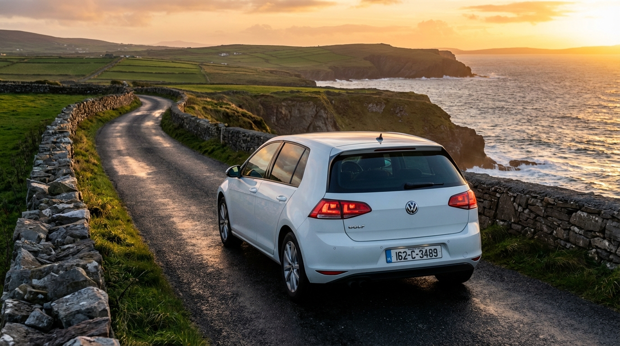
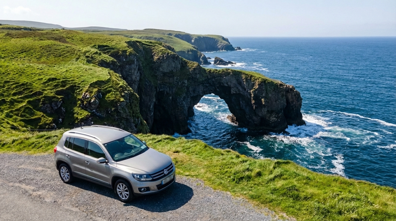
A self-drive on the Wild Atlantic Way is not the trip to take a rental car with a €1,500 excess hanging over it. The roads are remote, the conditions are variable, and the specific hazards — a pothole on a Connemara R-road, a tyre meeting a stone wall on a tight Kerry pass, a windscreen taking a chip from a gravel truck on the N59 — are the kind of minor incidents that turn into expensive claims when you're carrying excess liability.
My Irish Cousin's all-inclusive car hire covers tyre damage and glass as standard, with zero excess and no deposit required. No photos of the car at pickup or return. If something happens on a bog road outside Clifden at 7pm on a Tuesday, full roadside assistance is included — not an optional add-on. For a trip along 2,500km of some of the most remote road in Ireland, the peace of mind is not incidental. It's the practical argument for booking with someone who has thought about what a WAW self-drive actually involves.
Frequently Asked Questions
How long does the Wild Atlantic Way take to drive?
The full 2,500km route, driven without rushing and with time to stop properly at the major points, takes a minimum of two weeks. Most visitors do one or two sections rather than the whole route — our Ireland self-drive planning guide helps you decide which fits your trip. The Kerry section alone — Ring of Kerry, Dingle, Beara — is three to four days done properly. The Clare and Connemara section is another three to four days. Donegal adds at least three more.
Do I need a 4x4 or SUV to drive the Wild Atlantic Way?
No. A standard hire car handles every road on the WAW. A higher clearance vehicle is comfortable on rougher R-roads, but it's not necessary. What matters more than the vehicle type is driving pace — slow down on single-track roads, and don't try to maintain N-road speeds on R-roads. Standard estate cars and hatchbacks are fine.
What's the best time of year for a Wild Atlantic Way self-drive?
May, June, and September are the best balance of weather, daylight, and manageable crowd levels. July and August have the best weather odds but also the highest visitor numbers — in Kerry especially, the difference in road congestion is significant. October is increasingly popular for the autumn light and near-empty roads, but weather is less reliable.
Which direction should I drive the Wild Atlantic Way?
The official route runs south to north, starting in West Cork and ending in Donegal. Most visitors drive sections independently rather than following the full official route. For the Ring of Kerry, anticlockwise is strongly recommended to avoid coach bus traffic. For the wider route, direction matters less — follow what fits your starting point and your schedule.
Before You Go
The Wild Atlantic Way is best when it isn't a checklist. The stops worth remembering are rarely the ones on the official Discovery Points signs — they're the road above the lake you pulled over for because the light was doing something, the village pub you stopped in because it started raining, the unmarked cliff path someone at the B&B told you about the night before.
Give yourself more time than you think you need. Arrive in Kerry. Point the car west. Stop when something stops you. That's the plan.